This is supposed to be “easy” trekking.
Really, how hard can this actually be, walking only a few kilometers a day, stopping for tea every couple of hours, sleeping in proper beds, relaxing by night in heated dining rooms, and having every meal prepared by someone who isn’t me? This is like backpacking, but without any work! No food to carry, no sleeping pad, no shelter, and little else besides some clothes to keep us warm and a lofty sleeping bag. And all this, among some of the most amazing scenery on earth. This is trekking I can handle. It’s almost too good to be true!
Maybe because it is. Or at least, it was for me.
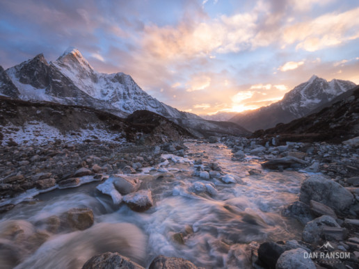
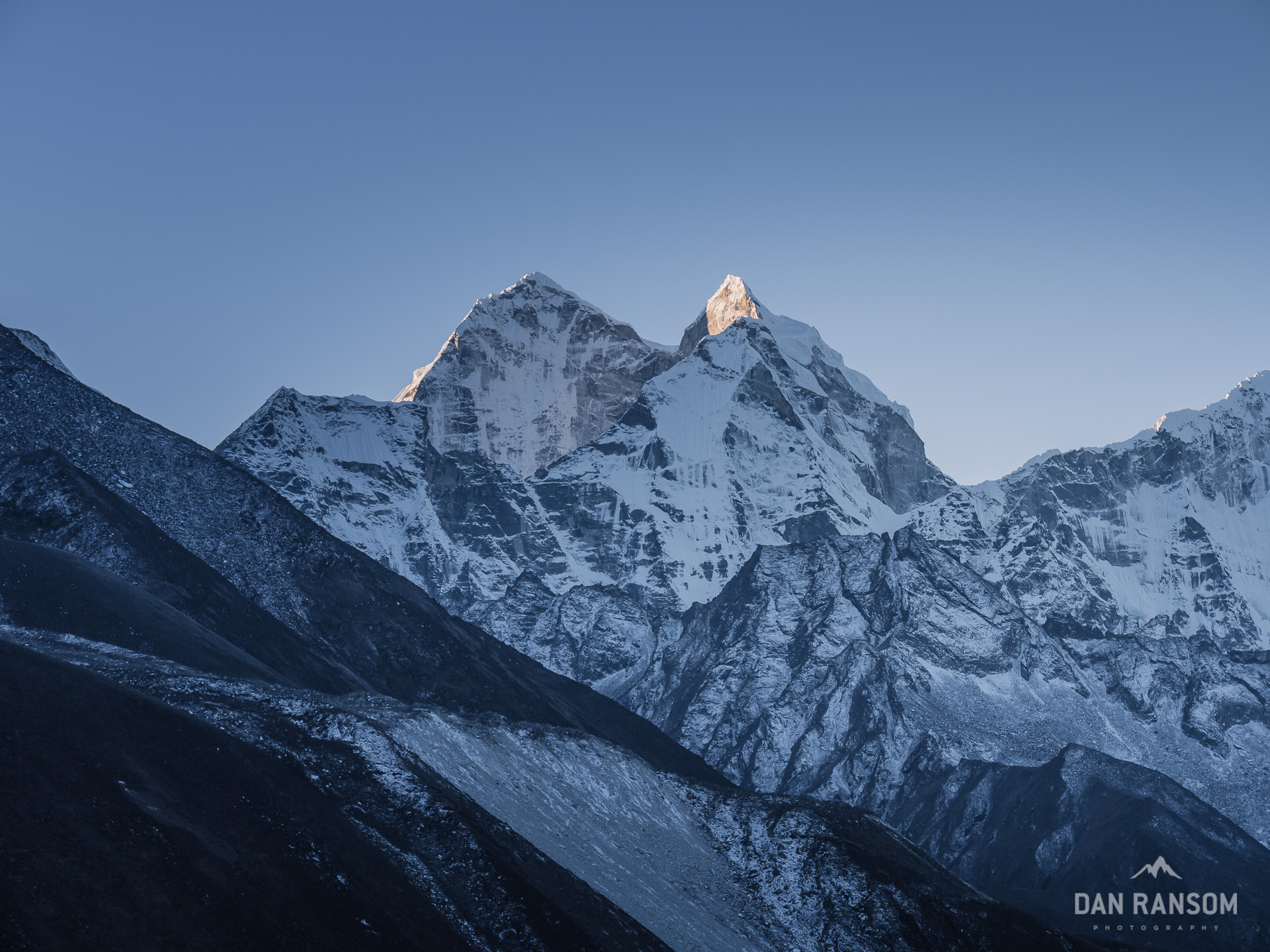
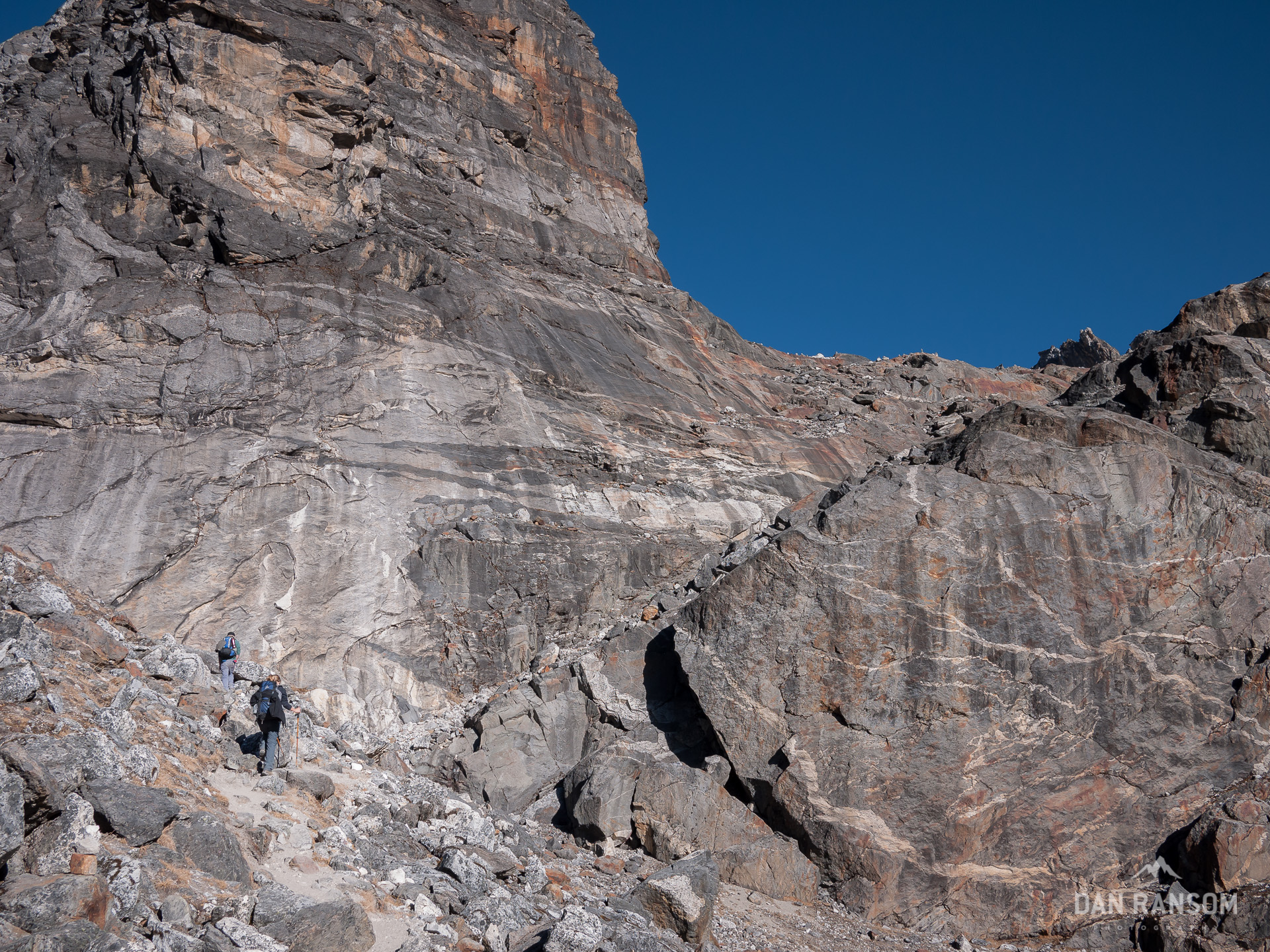
Classic scene along the trails to Everest Base Camp.
For the last two months, I’ve been wandering the Himalayas, chasing sunrises and sunsets, hoping to be inspired by fleeting views of the biggest peaks on earth. I sweated uncontrollably those early days, walking through the hot and humid middle hills, only to gasp for air a week later in the arid alpine valleys. I shuffled across breathless passes battered by wind and snow, sliding my feet along at a speed of slow that makes a glacier’s progress seem inspiring. I celebrated in style atop the highest point of my life with a ridiculously expensive Snickers bar, only to retreat 90 minutes where the thicker air would mean that damned headache would actually disappear. I pounded all the dahl bat a man could ever stand to eat, and then refilled it one more time, only to lose it all to the worst gastrointestinal bugs ever imagined.
Twice.
I spent fitful nights trying to sleep, only to be roused time and time again by the sounds of a brother battling the all-too common Khumbu Cough. And after a blizzard sent us out of the Gokyo Valley, we spent 3 days waiting for planes in Lukla where every morning dawned with more rain, and I was convinced that Groundhog Day was actually for real.
And perhaps the moment that hurts the most – the cloudless evening at Everest base camp, and the sunset I was so keen on photographing. The one where the moon would rise as the sun would set, and the alpenglow would light up Everest, Lhotse, and Nuptse. It should have been perfect. I should have had my camera on a tripod, just waiting for the perfect moment to capture one of the world’s most classic views.
At least, that’s how I imagined it.
But instead, I lied frozen in my plywood room, curled into the fetal position beneath the insulation of my sleeping bag, grimacing in pain as my intestines cramped uncontrollably. I tried in vain to squint through the window at the scene I knew was unfolding. But that only made my disappointment more intense. Slowly, the condensation on the window pane solidified to ice, a nearly full moon rose unobstructed over the towering east face of Nuptse, and the light fully faded, along with the photo I came all this way to make.
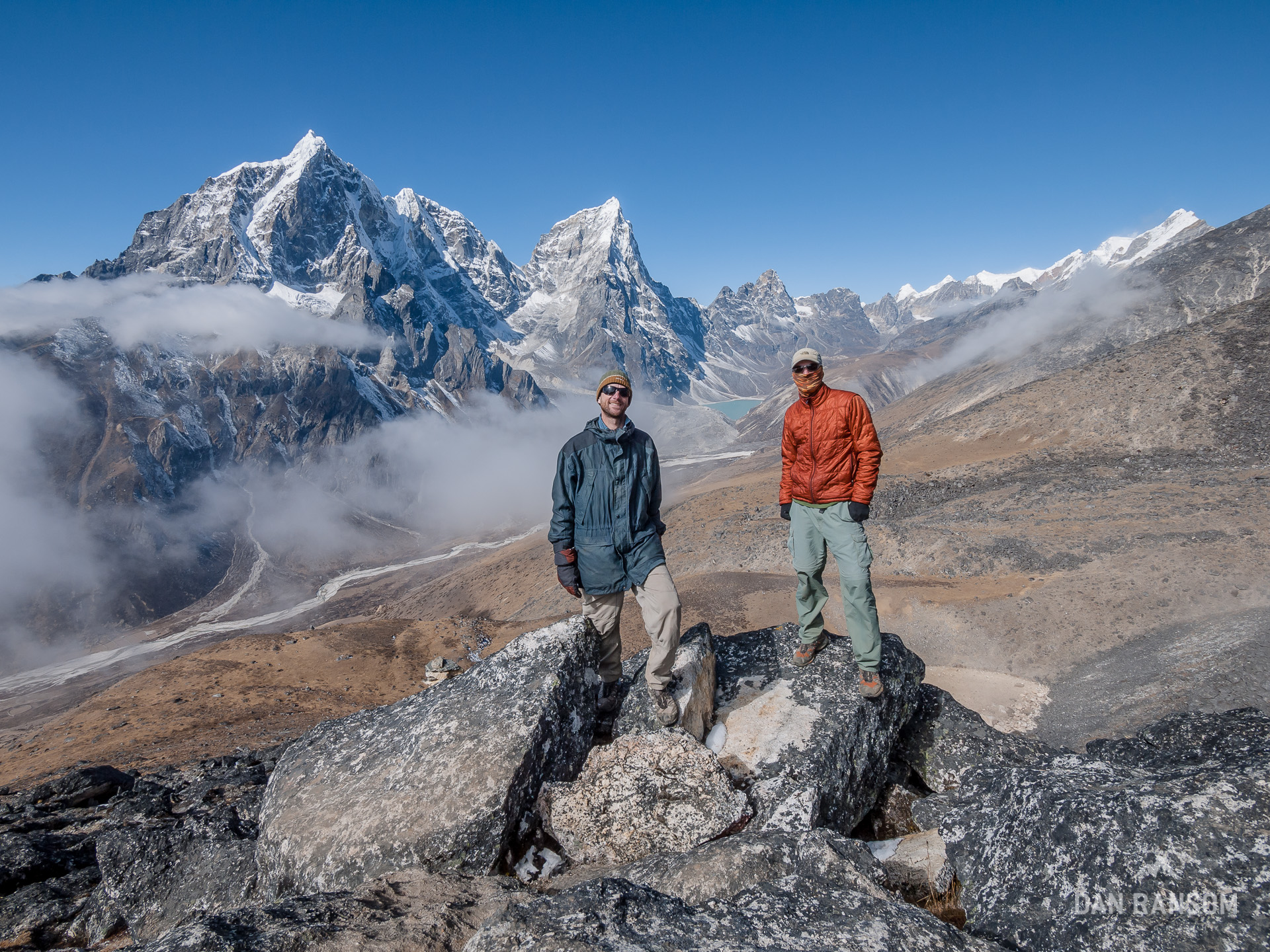
Yet somehow, we always managed to laugh it all off (often while gasping for air). We were a strange crew indeed; Brandon and I, the sarcastic American Brothers. Phil the Brit, who spared no opportunity to take the piss out of anyone so fortunate as to share a dining room table with him. And the Isra-Aliens, Dana, Nadav, Gilad and Yoav, who were quite possibly the finest Yanef players in the Khumbu. All of us at obviously different stages on the path of life, but all of us brought here by a common theme; the seemingly gravitational pull of experiencing the tallest mountains on earth.
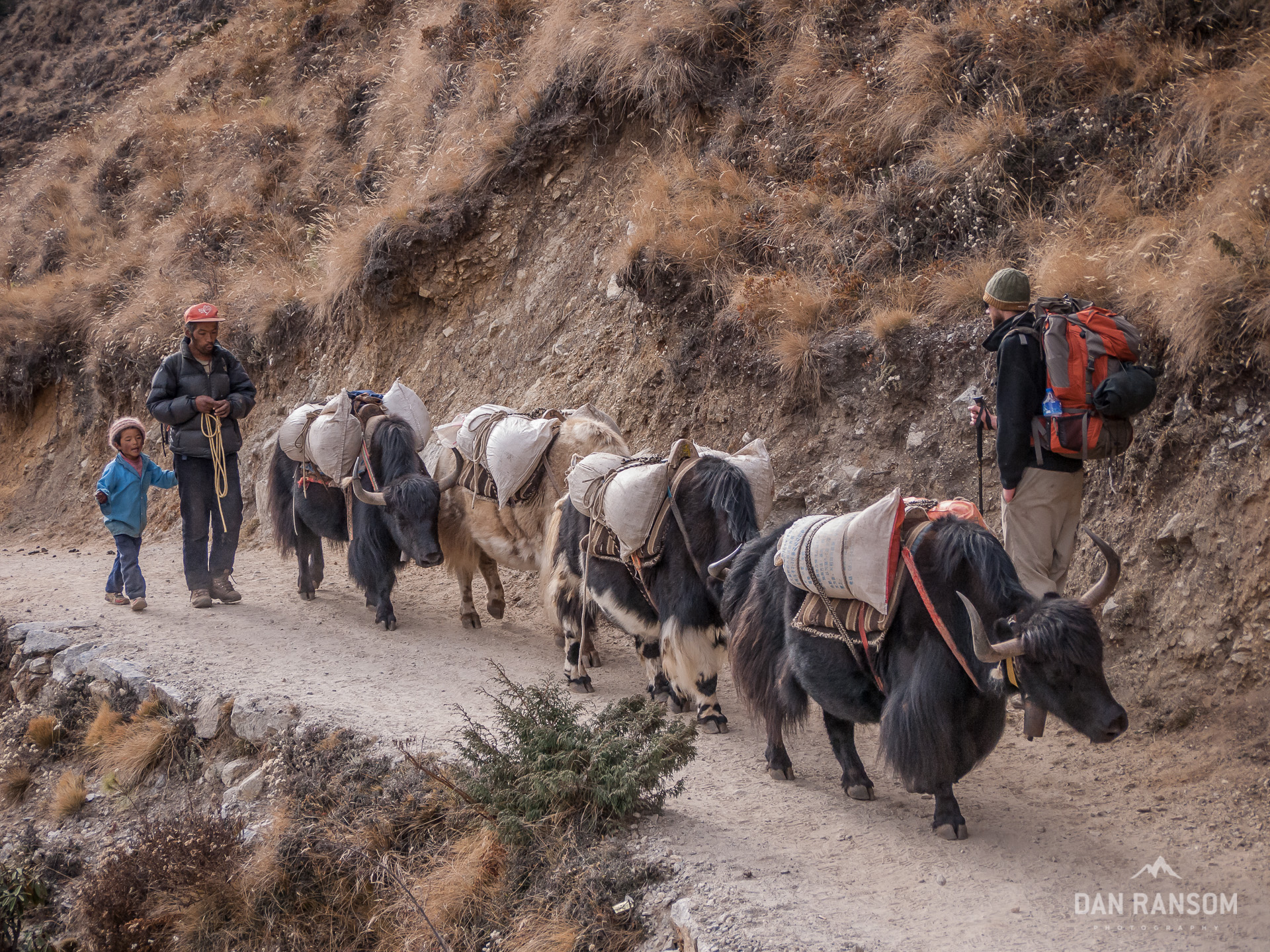
And that’s part of what makes the Khumbu so interesting. It’s one part mountains, one part local customs and culture, and when it’s peak season for trekkers, it’s one giant part international tourist. As we crossed into Sagarmatha National Park in Monjo, a hand written sign behind the desk tallied the trekkers for the month prior. Nearly 10,000 people.
Ten. Thousand. People. October 2010 had been the busiest month in the history of the park. Ever. That’s the equivalent of 300 people a day, on average. Sometimes it was 800. We were astonished.
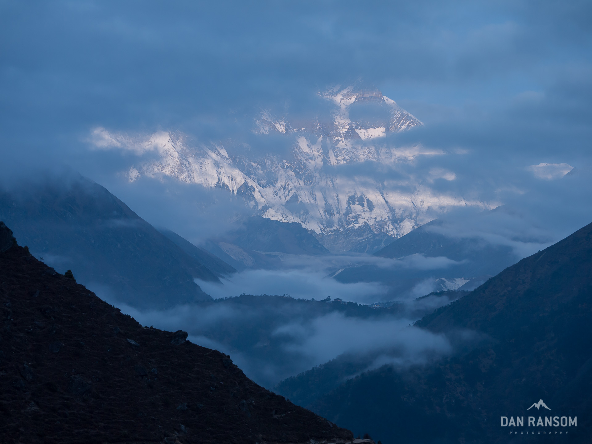
Yet, from here, it only takes a few kilometers to realize why – within a few hours we’d have our first views of the biggest mountain on earth.
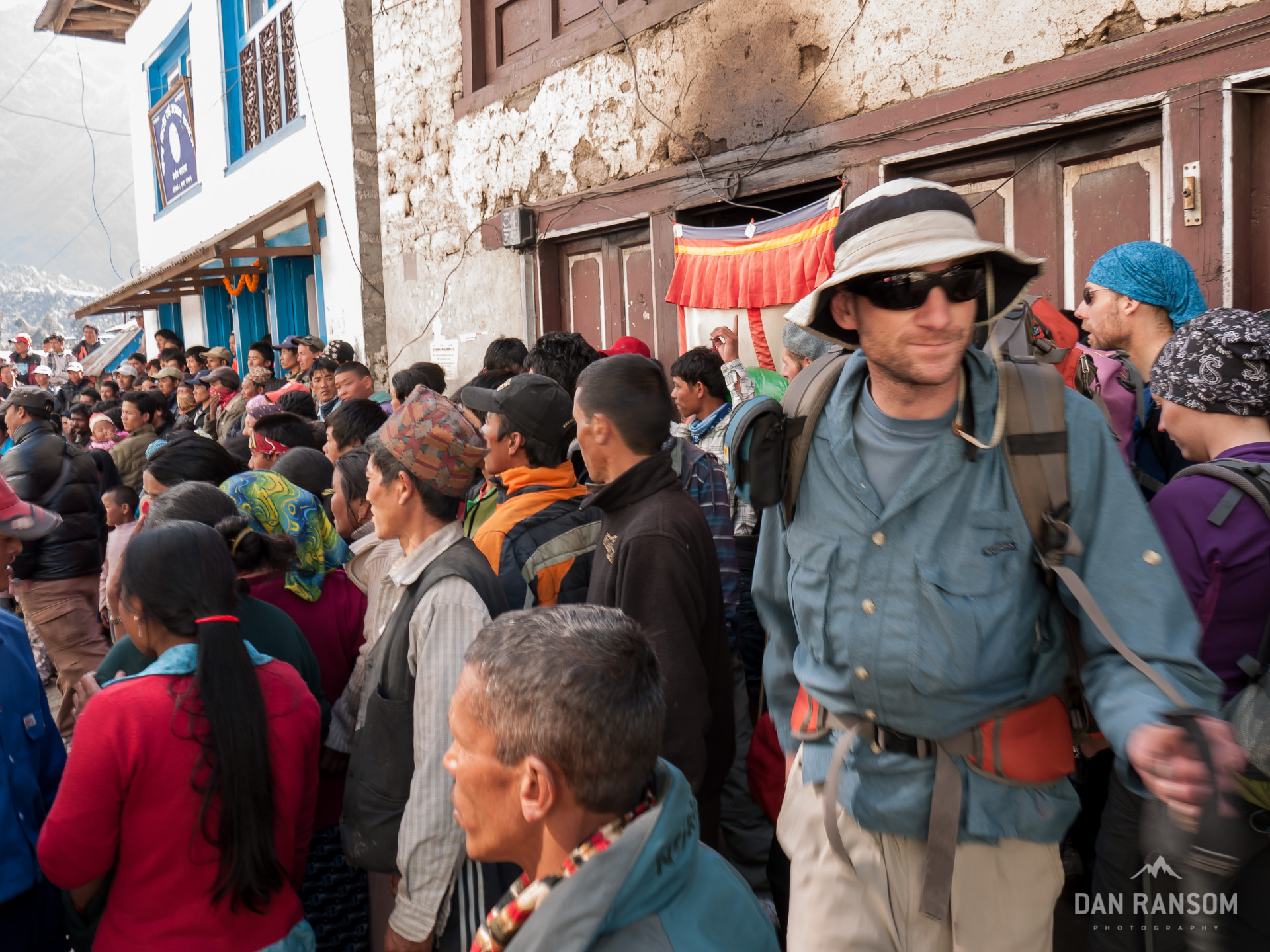
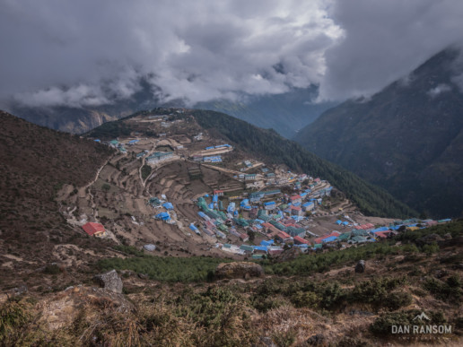
My brother and I sweated our way up the way-too-demanding-to-only-be-the-second-day climb into Namche Bazaar, constantly wondering where this place really was. The landscape just didn’t seem capable of holding such a large village. It was like a super-sized game of hide and seek, and there were multiple times we figured we had to be close, but no town in sight! Finally, we rounded the final small corner and caught a rather anti-climatic view of the town, the most famous Sherpa village in all the Khumbu.
This place hardly strikes me as a village. This is nearly a city! The small dirt roads are packed with all sorts of climbing and trekking shops, crowding out the dozens of multi-level hotels, all designed to handle the massive crowds of trekkers, guides, porters, and yak trains. The place even had an IME, stocked with all the best new Patagonia clothes, not to mention the official Mountain Hardwear shop, and the seemingly countless other stores selling North Fake and all other imaginable type of knocked-off outerwear.
We quickly grabbed a veggie burger (yes, you read right…) at the bakery, and randomly picked one of the many stencil-stamped lodges and settled in. The streets were chaotic, buzzing with souvenir hunters, shop owners, hard-core mountaineers, and local traders on their way to region’s biggest market. The lodges all looked new, the menus packed with dozens of interpretations of popular western foods, and every corner had an internet cafe. Money seemed to be pouring into this place.
As fast as the afternoon clouds effortlessly float up the Dudh Kosi valley, a sobering realization swept through my head. Of all the places in Nepal I’ve seen, I think this may be the place that has been impacted the most by tourism, for better or worse?
One can’t help but wonder. But as the eyes scan a seemingly infinite landscape of mountains, each twice as tall as anything I have ever seen before, my mind is quick to find a different sense of wonder.
There’s clearly a few reasons this place has such a strong magnetic pull.
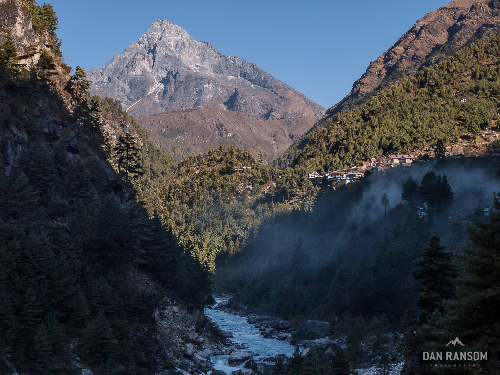
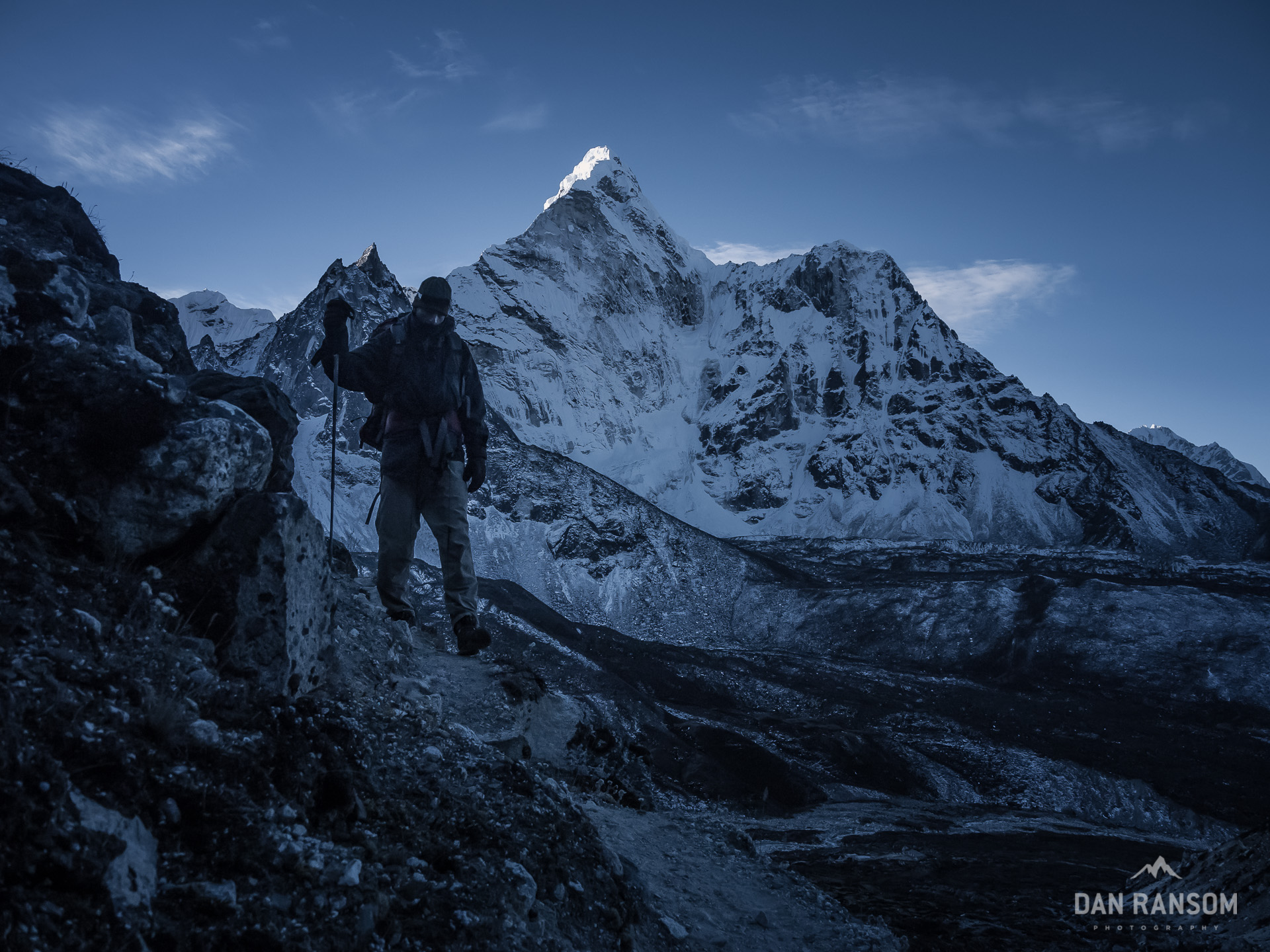
Namche sits at around 3400 meters, pretty close to treeline. And once the trees start to thin, and you’ve climbed above the steep gorges of the middle hills, it’s simply one jaw-dropping view after another. And it’s definitely not just because of Everest. From here, it’s hardly inspiring at all. Some go so far as to call Everest the fat ugly man in a room full of beautiful women. Lhotse, Taboche, Arakam Tse, Thamserku, they are all awesome, and worthy of every cliché adjective that’s ever been applied. But one of them is even more beautiful than all the rest.
We’d find ourselves walking below her slopes for the next few days, and often I could hardly keep my feet on the trail. I’d have to stop and stare, shake my head, look back up again, and then turn around and shout back to my brother, “Ah-Ma DEE!”
Somehow, that became our nickname for the prettiest lady in the Khumbu, Ama Dablam. Maybe because I talked about it so much I finally just had to cut off the last syllable so I could catch my breath again. Fortunately, our itinerary would give us plenty of time to gaze up at her, and multiple opportunities for what I really wanted from her; a chance at a good photograph. It almost became an obsession for me. I woke up every morning before dawn, and I stayed out late after sunset, every night, hoping to capture an image of her that could somehow resemble the awesome view she presents in reality. It got so bad, I even had a few dreams about her, only to be ousted out of bed at 5:00 am by my alarm reminding me to get out of there and go chase some color in the sunrise.
Some day, if I ever cared about mountaineering, it would be because of Ama Dablam. For now, I’ll have to settle for a more simple celebration in her shadow. Today, as most days, the afternoon clouds barrelled up the valley and obscured pretty much every chance at making some nice pictures. But as the sun started to set, the clouds began to break Tonight, the clouds stayed just high enough and were clearing, instead of staying low and building.
As the clouds broke apart, the sun battled through their seams, and began to set squarely between the towering slopes of Ama Dablam and Taboche. Fortunately, I had scouted a scene I wanted to shoot at earlier in the day, and I quickly grabbed my gear, slung it over the shoulder, and jogged the few minutes down to the Imja Khola. A spectacular scene unfolded, treating me to a show that wouldn’t be matched again for the duration of the trip. I bounced back to the guesthouse, feeling fortunate to have finally watched the sunset I only dreamed would happen.
Lady Luck was not always so kind to us. About an hour after leaving Tengboche, I slowed down. A lot. Something wasn’t right. I was feeling lightheaded, and had no energy. My first thought would be the altitude, except for the fact I had just finished the Annapurna circuit, and spent 7 days above 4000 meters already. We were only at 3700. I reasoned I should be just fine. But, I popped a diamox anyways, and decided to take it easy the rest of the way.
That night, I realized it had nothing to do with the altitude. A cramp in the stomach and a quick sprint up to the squatter gave me all the information I needed. Somehow, I’d caught a GI bug, and my body was determined to get rid of it… By any means necessary.
Bad water, bad food, bad hygiene? Impossible to say, but ridiculously common up here. I was carrying a z-pack, and the pain was getting more intense, so I popped the pack, hoping for a quick fix. I woke up the next morning feeling slightly better, but in no shape to do any hiking. I opted to stay in bed, while my brother checked out Ama Dablam base camp.
By early the next morning, I had finally kept down some food, and we decided to make the short walk from Pangboche to Dingboche. Originally, I thought we might be feeling saucy enough to tag Nangartshang in the afternoon, but given my lack of reserves, we decided to head up in the morning. It was the first real frustration of the trip. At this altitude, it’s definitely not the distances that take a toll on a person. Most of the time, you barely walk for 3 hours in a day. It’s the elevation, and it is just silly to try and push it. And if the altitude doesn’t get you, there’s a good chance a stomach bug will.
With a good night’s rest, I woke up feeling much stronger and ready to head up the small high point above Dingboche. Brandon was charged as well. We threw down a quick breakfast and started our way up the ridge, trying to make our way around the slower folks. A quick look up the hill revealed even more ahead of us. This is the price of admission, I reminded myself.
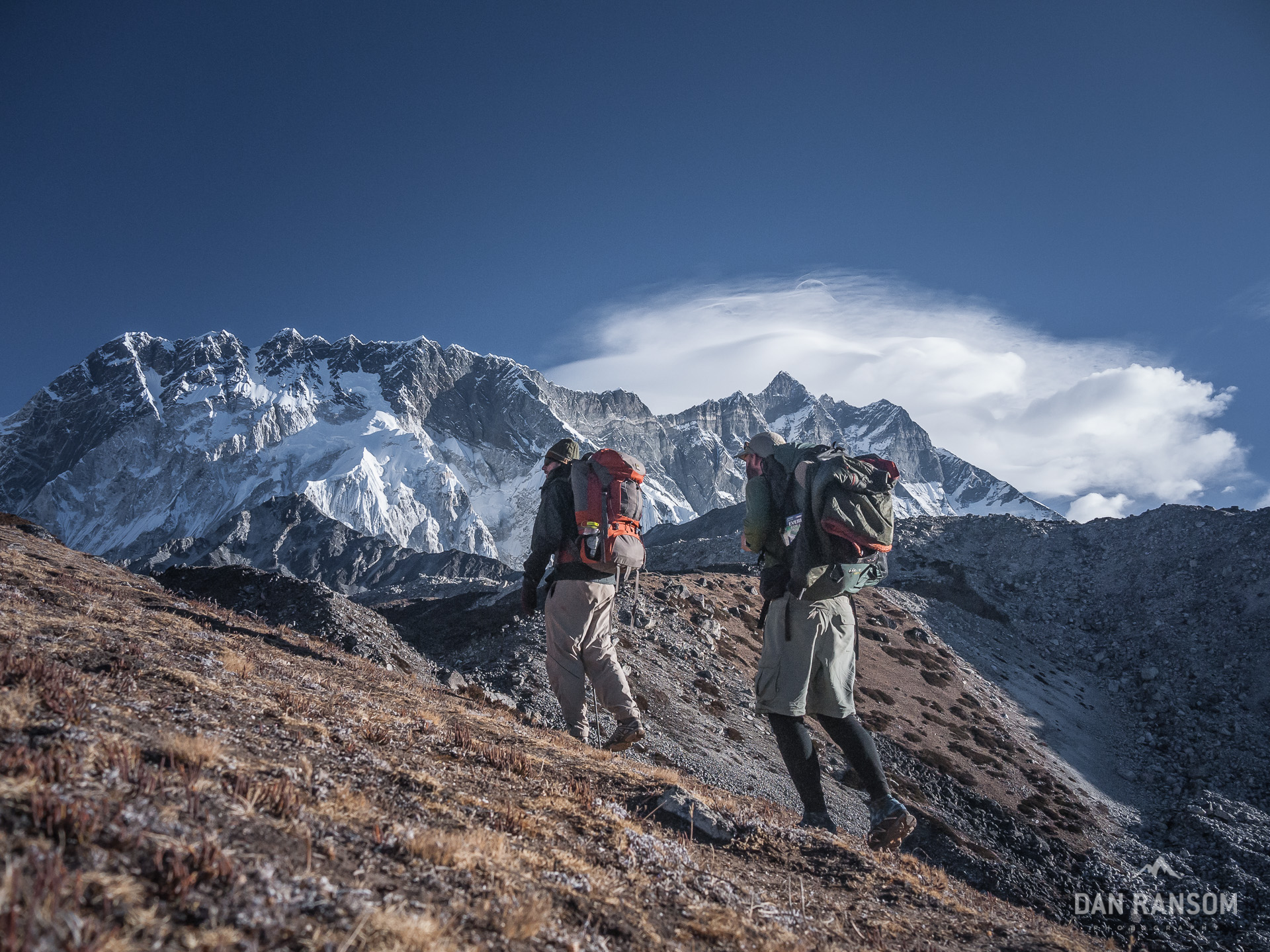
Brandon smoked everyone up the hill, obviously anxious to do a little more taxing work for the day. I slowly plodded along, trying not to lose my breath or strain myself. Finally, we reached what was little more than an intermediate highpoint on the ridge that continues on to Pokalde. But, without a rope, it’d be an exposed stretch to get from here to the next section of ridge. At about 5000 meters, this was the spot for us to kick back and enjoy the view, with views of Taboche and Cholatse to the west, Ama Dablam just a few kilometers to the south, and the huge valley with Island Peak being dwarfed by the 8,000 meter Makalu to the east. It also represented a new high point for B. Nice!
The afternoon clouds reminded us to finally start heading back down around noon, and we grabbed our bags to head for Chukung. It’s not a far walk, but an increase from 4400 meters to 4700 meters. The scale here just blows my mind. Simply walking into Chukung takes us higher than any single spot in the lower 48. We chose to take another day here to acclimatize before heading over Kongma La. We didn’t realize we’d be forced to take one.


This time, however, it wasn’t me. I was back to feeling pretty strong, almost 100 percent. But B was obviously slowing down. I stopped a few times on the walk to Chukung to see how he was doing. Just this morning he was flying up to 5000 meters effortlessly, and now, he was ready to throw half the stuff in his pack in the river, just to lighten his load. The altitude was taking it’s toll. The tell-tale headache of AMS started to set in, and we knew we’d be taking it easy for a day.
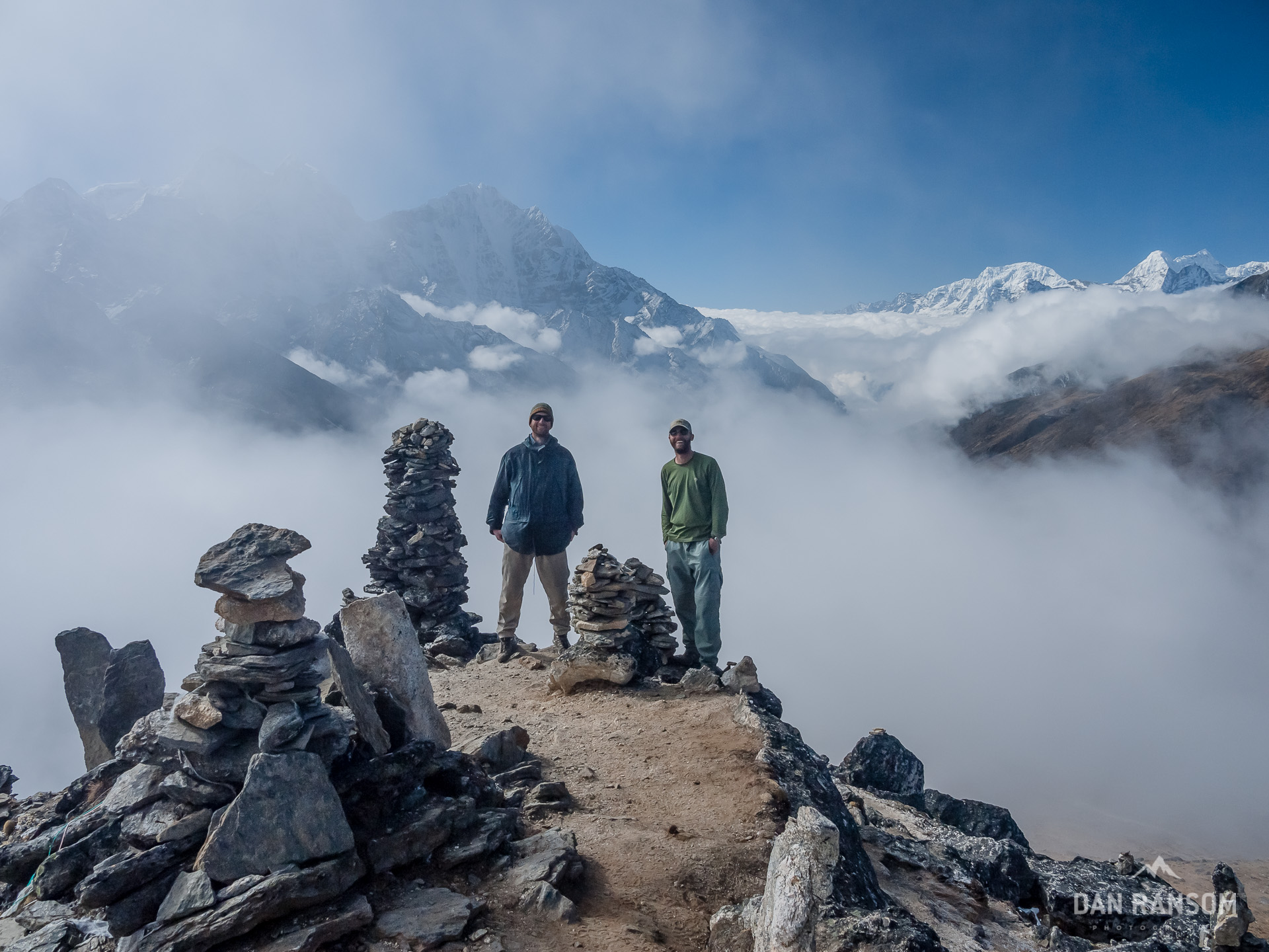
There could be worse places to hang out for a few days. Chukung is beautiful and much less crowded than the main trail to EBC, but it still has a lively crowd. It lures many of the more adventurous trekkers, and of course, the climbers, almost all headed for Island Peak. One could easily spend a couple days, bagging Chukung Ri, heading out to Island Peak base camp, or just wandering the huge glacial moraines that fill the valley.
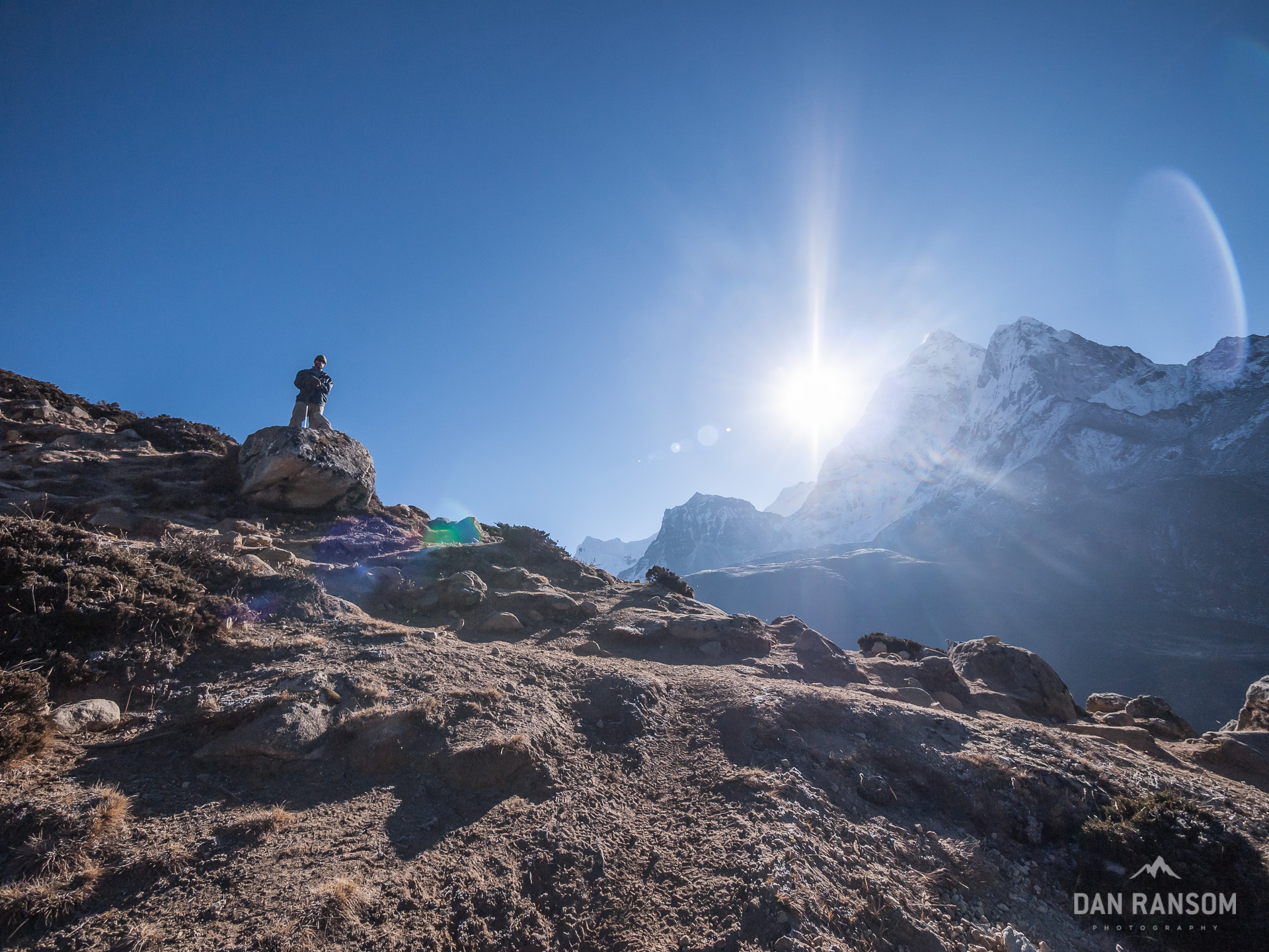
Hard to go wrong in any direction, and I often just grabbed my camera and went wherever looked interesting. My curiosity taking me first up Chukung Ri, where a phenomenal panorama of peaks unfolds. The massive south face of Lhotse looks close enough to touch here, along with the huge ridge to Nuptse. Makalu, like the next door neighbor who is just beyond the fence, peered over the Imja Valley’s icy ridges eager to strike up a conversation as soon as we could get within earshot. And way off to the north, the perfect pyramid of Pumori represented an easily recognized landmark for where Everest Base Camp and Gorak Shep would be, and where we would be in just a few days time.
I snapped a few photos and trundled on back to the guesthouse. Brandon was still chilling, trying to shake off a headache he described as “worse than a hangover from a two-day bucket bender in Thailand…” He was feeling greatly improved however, and it looked like nothing more than a typical high altitude headache. He quickly recovered, and bagged Chukung Ri the next morning, setting us up nicely for a trip over Kongma La, and into the fabled Khumbu valley.
Kongma La gets a bad rap from a lot of trekkers, and I’m not really sure why. Rumors of a bad trail, that’s hard to follow float through the trekkers teahouses pretty commonly. It’s also quite high, at 5545 meters, making it difficult to do without proper acclimatization. We’d taken 4 “zero” days already, were now symptom free, and were back to feeling pretty fit. We decided to set off early in the day, to try and avoid the crowds that plagued us on Nangartshang.
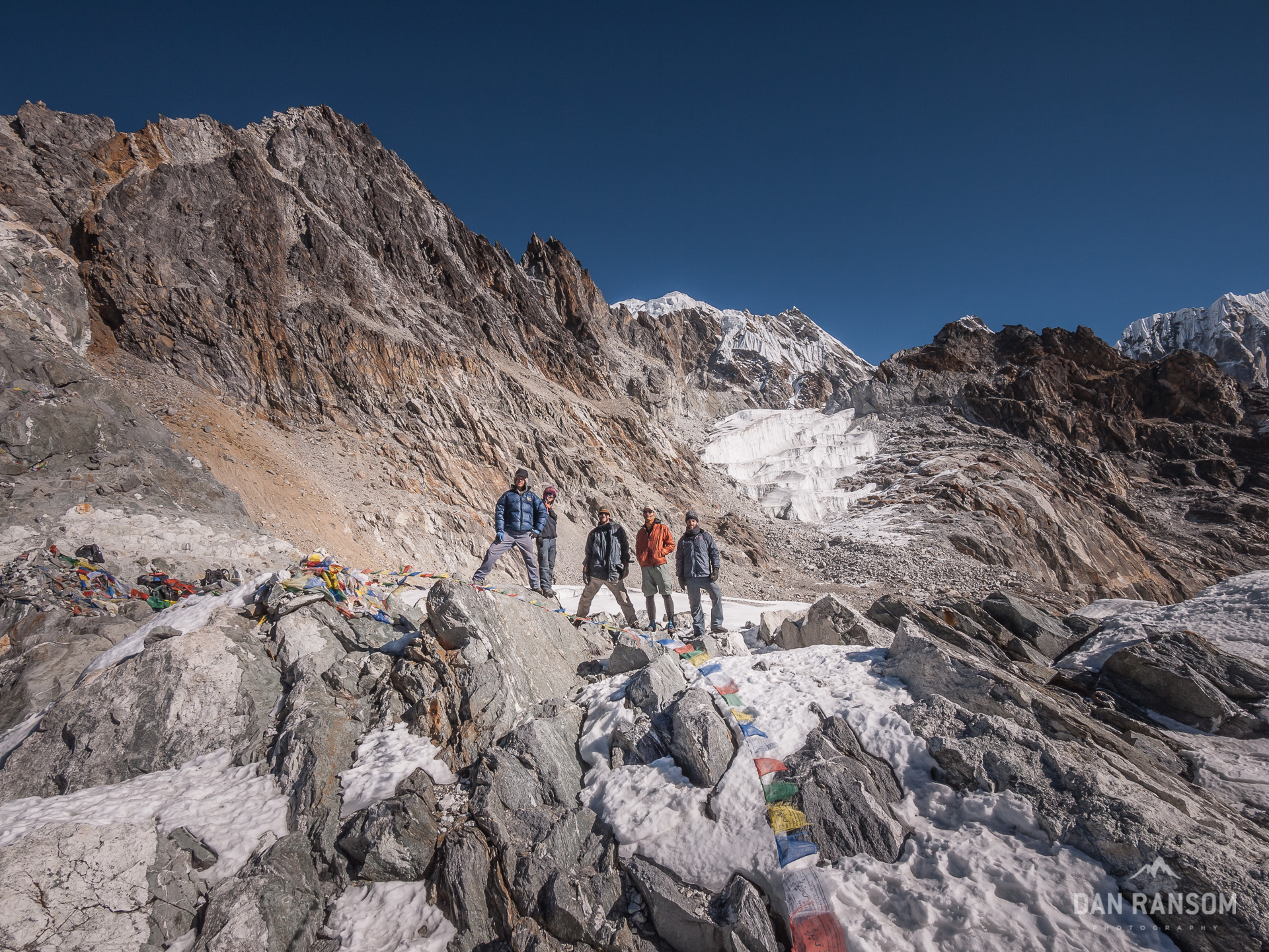
Having scouted the route from Chukung Ri a few days before, I made a few mental notes to help us get on the right track, since we’d heard all sorts of conflicting reports on how to find the trail. Turns out, it isn’t difficult to find at all, but there are a handful of little trails, ultimately all leading to the right place. We picked our way across the Nuptse terminal moraine, and eventually onto a grassy ridge that led straight into the Kongma valley. By 10 am we were cranking out wai-wai noodles and hot tea on the camp stove, and waiting to see if Yoav (who I’d met earlier on Annapurna) and Phil might be joining us soon.
Within an hour, our party of four was together, and we hung out enjoying the awesome views and nice weather. Two hours on the pass though, and we could feel the altitude wearing away at us, with Brandon and I both getting the itch of minor headaches. Time to head down. We picked our way through a bunch of ice and scree, and eventually to the very steep northern aspect of Pokalde, which would lead us across the labyrinth of the Khumbu glacier, and into the little village of Lobuche. The thought of thicker air propelled me down the slopes, and by the time we reached the village, everyone was headache free.
Lobuche is another one of those villages in the Khumbu that has a legend to precede it. Probably as a side-effect of Krakauer’s book, which pretty much describes it as a complete fucking shit-hole. Escaping it without getting a stomach bug should be celebrated as a significant victory. Considering this, perhaps I was biased before we even got there, but upon seeing the condition of the rooms, and the inflated prices for food, and the general feeling of the place, I was glad we only had to stay here for one short night. We’d be off to Gorak Shep in the morning. But, maybe the legend of that place isn’t so far from the truth…
By the time we shuffled into Gorak Shep the next morning, a significant weather system started to move in through the valley. The sky was masked by ominous clouds, and it looked like snow was imminent. I wandered around the lateral moraine a couple of times, and every time retreated back to the lodge, joking with our new friends that the storm was going to clear. Everyone shrugged me off and kept playing Yaneff, or any of a dozen other card games to pass the teahouse time. One can only huddle around the yak-dung fireplace for so long.

I continually joked that the storm outside was going to clear. (the storm inside, however, was getting worse…) By 8 pm, it was obvious my stomach was starting to feel the pain again. By taking a z-pack early in the trip, I figured I’d be even more susceptible to sickness, and it was clear round two of the stomach bug was starting to rear it’s ugly head. Perhaps a souvenir from Lobuche?
At about 4 am, a dozen or so trekkers set off for Kala Pattar, which is THE destination for most trekkers. I woke up, hit the head, checked the sky, and since I could barely sleep anyways, I persuaded B to head up the hill with me. By 5 am we were rolling, headed up what couldn’t be reasonably considered anything but a small little bump on the southern ridge of Pumori. A true high point it is not, but this morning, there wasn’t a cloud in the sky, and a world class view seemed a guarantee.
If only it wasn’t for that nasty stomach bug. I’ll spare the messy details, but let’s just say there wasn’t anything fun about that two hours trying to get to the summit. Period. It was brutal. I should have stayed in bed. Except this is Kala Pattar, and I didn’t come all this way to miss it. Finally, I pulled myself to the top, tried to fake a smile, snapped a photo with my brother, and then took off at a breakneck clip to make it back to my bed. Pretty sure I was back in the room 26 minutes later, but at least it was emergency-free.
I came, I saw. Or so I thought. Problem is, the sun rises behind Everest when viewed from Kala Pattar, so it’s pretty hard to make a decent image at sunrise. Best time of day would be the afternoon, when the sun was setting. However, it’s very rare that the mountain stays clear in the afternoon. What’s more, this was two days before a full moon, so I knew that the moon would rise an hour or two before the sunset. This could be a perfect photo opportunity. And of course, as I layed in bed, with intestinal cramps seemingly ripping my innards asunder, the weather stayed clear, and the scene I thought might play out was indeed doing just that.
What the hell, why not? This is too good to pass up! It’s just a stomach bug. I’m going back up Kala Pattar.
I struggled through packing up a bag with some warm gear, a tripod, and the camera, and started making my way back up the hill.
Slow. And. Steady. One foot in front of the other. I can do this.
Oh man, I can’t do it. Sit on some rocks. Try and recover. Push forward another 20 yards. Back to the ground. Think of the view man! You can do this! 20 more yards. Oh no. Hit the deck. Head between the knees. I want to puke. Deep breaths. 20 more yards. How is this happening NOW? This isn’t irony, this is torture.
And so it went. For an hour. I made maybe 600 meters, tops. I just couldn’t do it. I retreated back to the room, back to that menacing plywood excuse for comfort. Back to my sleeping bag, which represented the only real chance and staying warm. And back to the tiny glass window pane that let in just a fraction of that classic view I wanted to so badly to photograph. Painfully, the opportunity slipped pass me, untouched.
Fuck.
A day later, and feeling better, I was anxious to get out of Gorak Shep, and see some new scenery. Amazingly, I felt nearly 100 percent. I couldn’t believe it. We cruised through Lobuche, started the gradual contour towards the night’s stop at Dzonghla. We were there before noon, arriving to the most bizarre of all the villages we would see.
Take any reputation that Lobuche might have had, multiply it two-fold, and you have an idea of what Dzonghla is like. Only this place was still worse. Completely and utterly disgusting. Trash was tucked behind every boulder big enough to hide a two liter bottle or square of toilet paper. Rats raced through the dorm rooms trying to find any food left unsecured. An emotionless child (who looked worn out, no doubt abused by hundreds of angry trekkers before us) stared blankly at the faces of those placing orders, nodding only to acknowledge he had actually heard them. Food is guaranteed to cost nearly double what it does everywhere else, but whether or not the food came out warm was no guarantee. Human feces literally overflowed the only toilet available. And the smell was so horrific, people had no choice but to go find another place, preferably behind a huge rock for some privacy, only to find that dozens of other people had the same idea.
There are few options to trekkers for this leg. To do the whole section from Lobuche over Cho La and down to Thagnag is possible, and entirely doable, but makes for a big day. Resting halfway is the logical way to do it, with a final push into Gokyo, but in hindsight, it is the worst idea possible.
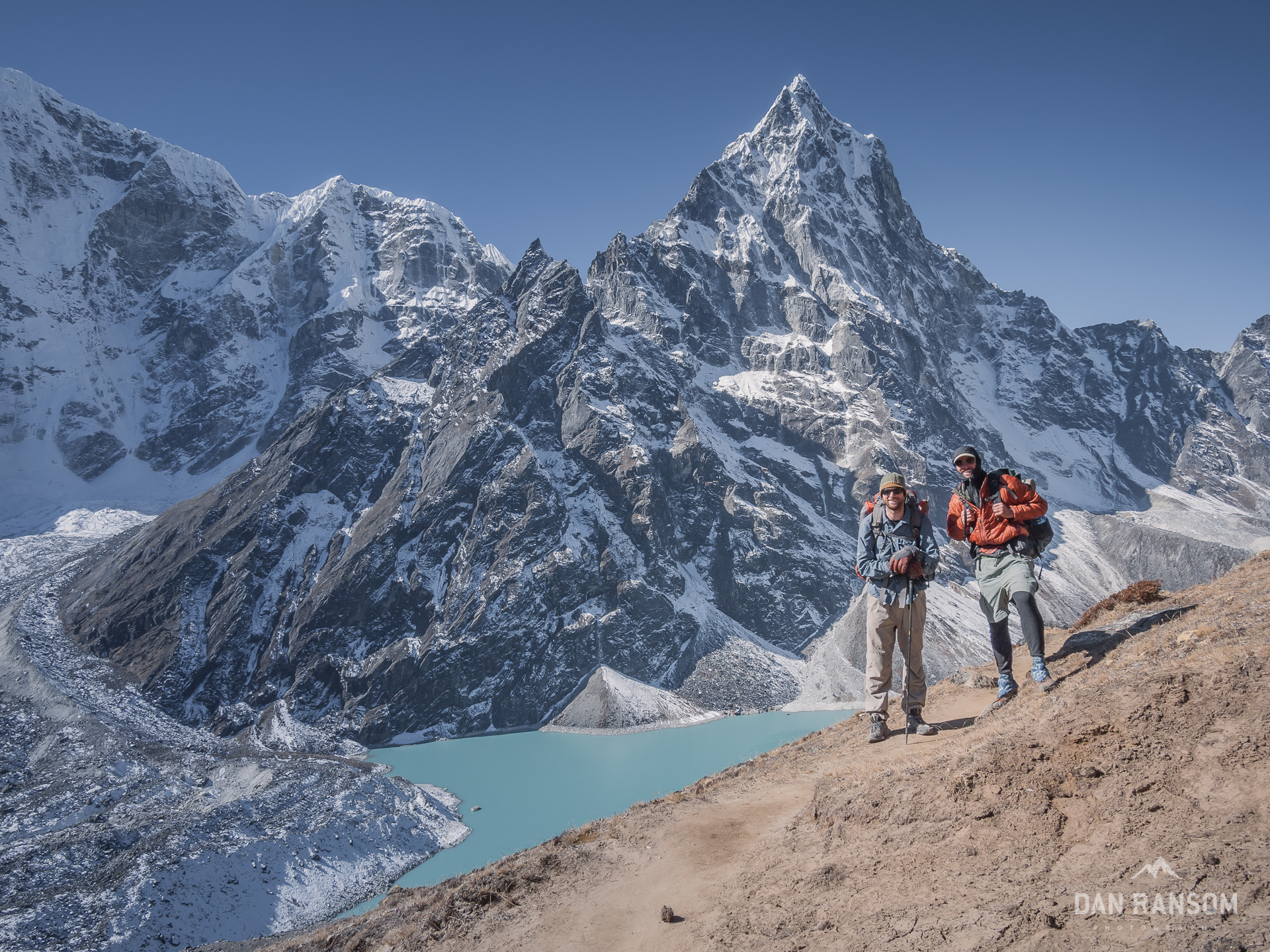
It’s a shame the small little teahouse there can distract so strongly from the overall atmosphere of the valley. Excepting Dzonghla, it is one of the prettiest places on the trek. Taboche, Cholatse, and Arakam Tse form huge vertical walls on their north faces. To the north lies the Lobuche massif, and to the south, Ama Dablam frames the valley, reflected in the glacially dammed lake of Cho La Tso. If the wind is quiet enough to allow it, it could be truly magical.
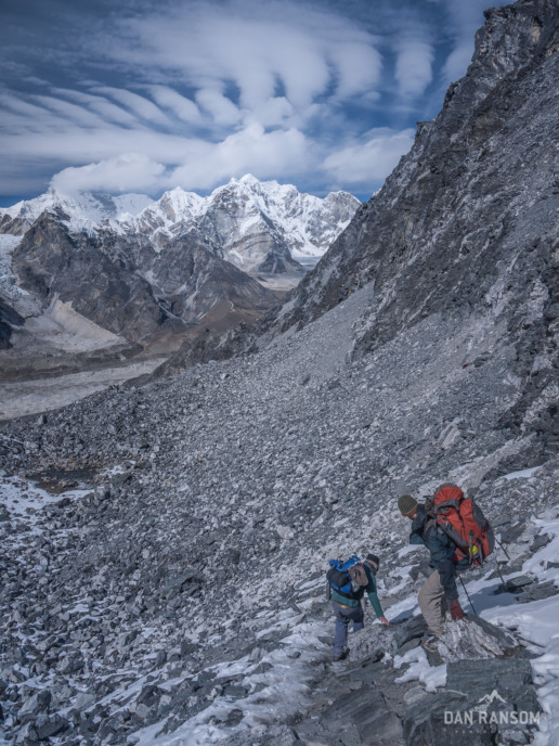
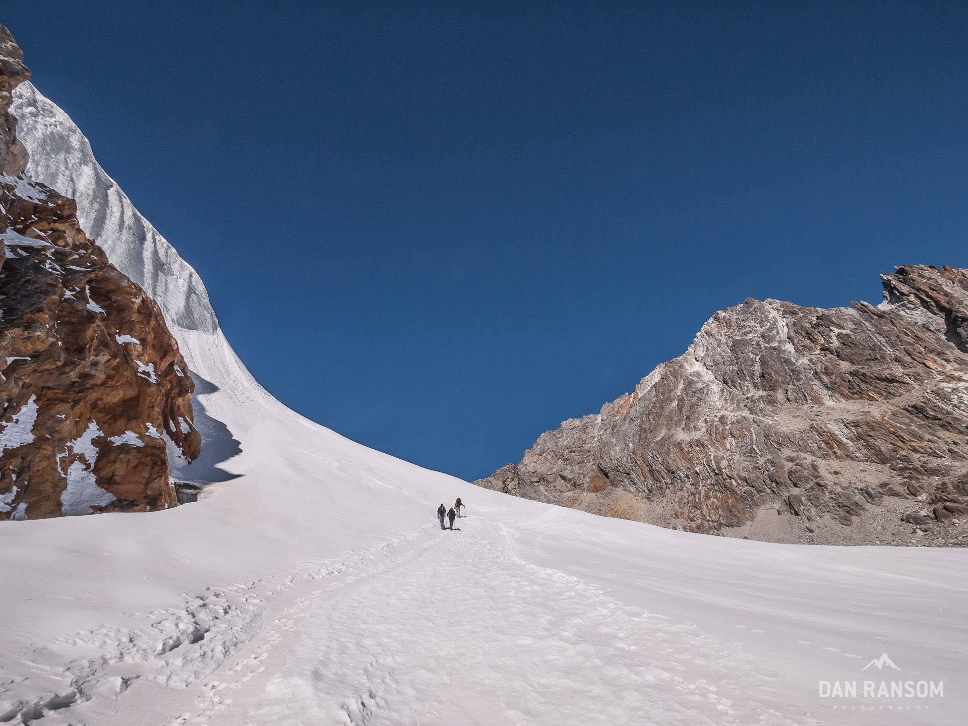
Ascending Cho La Pass, and the start of the Glacier.
It really is amazing that all of us made it out of there without any significant issue. The place certainly made it easy to be motivated for an early departure in the morning. We were out of there by sunrise. By the time the little hotel was out of sight, it was hard not to be awed by our surroundings. We slowly climbed higher, and I think all of us made the mistake of thinking Cho La was one valley to the west of where it truly is. When we finally approached the end of the valley, and saw where the trail truly went, we were even more speechless. While we were slowly shuffling along, one porter had already lugged a huge load to the top, and was sprinting down the hill to help his clients with a second. He got a chuckle out of a few of us, along with a few mumbles of “unbelievable.”
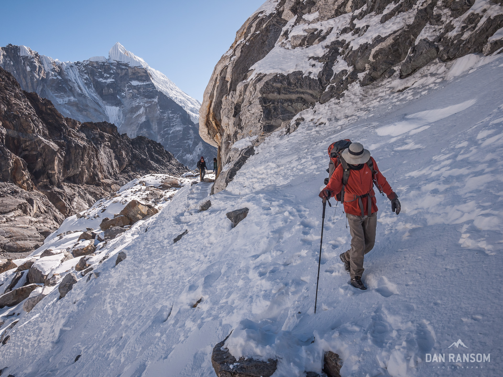
After climbing the steep rock ramp, the route mellows out quite a bit, and then makes it’s way across the Cho La glacier. It’s not much of a glacier by Himalayan standards, but it did require a good half hour of walking on snow and ice, and one significant crevasse that had to be skirted, but never crossed. Once on top, we took a few celebratory photos, shared the few chocolate bars we had left, and then made the nasty descent down the other side, following a semi-cairned route across a boulder field that simply leaves you scratching your head. “Is that really the trail?”
Compared to all the other major trekking routes i(which tend to be as big as roads and nearly paved like one too) this was actually pretty steep and required some attention. Yaks almost certainly couldn’t cross it. Which means there is a lot less traffic too. It was a very tangible transition heading into Gokyo leaving EBC behind and all of its crowds, and a very welcome transition at that.
We moved efficiently and made decent time, arriving in Thagnag around noon for lunch. The sky was cloudless, and beautiful. I knew we were at least a few hours ahead of some of our group we had met the night before, and there would be some waiting around to see where everyone would end up. I was quite astonished to feel as good as I did, considering the stomach bug just two days earlier. I looked at my watch, and my brain started wondering if I could actually make it to Gokyo today, and up Gokyo Ri in time for sunset. All I could think of was getting a chance at redemption after missing the sunset at Kala Pattar.


I was feeling strong, so I took off at a quicker pace, hoping to cross the Ngozumpa glacier quick enough to have a chance at Gokyo Ri before sunset. I passed a guide and client around 1:45, and asked how far it was to Gokyo. One and a half hours, they said. And then how long up Gokyo Ri? 3 hours, round trip. The sun sets at 5 pm this time of year. They said it wasn’t possible, it was too late, and it was certainly going to cloud up, pointing to the first signs of clouds coming up the valley.
Nice to have a little motivation. I scrambled over the moraine into Gokyo around 2:20, looking back for signs of the other 3. Quickly I went into the village, found a room, and told the lodge owner to keep a look out for the really tall skinny guy in a group of five, and wave them to your place when you see them. I bought a couple of snickers from him, stuffed them in my pocket, and asked him how long it would take to get to the summit. No more than 2 hours. 4:30 pm, if I can keep a solid pace. Perfect.
A quick glance back to the south, and the clouds were continuing to build. In typical fashion, the clouds roll up the valley floors, swallowing up all the views as they slowly climb higher and higher. Suddenly, I wasn’t so confident about my decision.
Nonetheless, I headed out. Pacing myself so as to not lose my breath, I kept a good rhythm for about 30 minutes. Stopping to survey the scene, it was obvious the clouds were building, and building fast. In ten minutes I figured to be entirely in the white mist, and barely able to see 50 meters.
If I can just get higher, I might be able to break through.
That was all I could tell myself to keep going. Group after group passed me. All going down. All wondering what I was doing going up. One Danish guy was brash enough to ask what in the world I was thinking, pointing into the clouds engulfing us and without saying anything else, seemed to ask “do you not see all this?” I just looked him square in the face and told him “It’s going to clear.” I only half believed it, but I wanted to prove him wrong. If nothing else simply to spite him and that cocky attitude.
By 4 pm, I decided to just sit down and wait. My strength was starting to run out. I had pushed myself pretty hard today, especially considering two days earlier I couldn’t even get out of bed. Thoughts of a nice sunset had propelled me this far, but I was pretty sure at my current pace I wouldn’t make it in time anyways. The struggle was just beginning.
Had I been able to see anything at that point, I might have realized I only had about 100 vertical meters to go, and maybe 15 or 20 minutes of actual hiking. What I figured was the last group to come down passed me, all with big smiles. And I imagined, certainly with great photos, as they had to have been above the clouds for much of the day, only to see them come barreling up the valley.
“Up or down?”
“Going up.”
“Well don’t stop, you are almost there!”
Only ten minutes before, they said it was still clear at the summit
Unbelievable! Re-energized, I stood back up and started walking. But the energy didn’t last. It was obvious I had been pushing too hard all day, and now, in that thin air, I simply couldn’t walk as fast as my camera wanted me too. I was maxed out entirely. I couldn’t believe it was happening again. I was crashing!
I was frozen, trying to focus on slow methodical movements, when I actually realized what was happening. I had hit the cloud ceiling, and it was starting to clear. I could faintly see some of the distant peaks. A few patches of blue opened up. The clouds were swirling and moving fast, but the ceiling was near. In this landscape of unfathomable heights, measured by the thousands of meters, I figured it was only a dozen or so more, and I’d likely have a clear view once again.
The excitement got my engine revved back up, but it didn’t help. I couldn’t get any power to my legs. No strength. Nothing. Zip. Zilch. Nada. The tank was empty, and even the vapors long burnt. No rational thought could make me get back up. Hell, I couldn’t even think, it seemed like it was too much work. I’d have been fuming mad, if I had any energy to actually be angry.
It is difficult to explain exactly what it feels like to hit a wall. Unless you’ve ever bonked, it’s impossible to understand why someone can’t just keep going. One foot in front of the other isn’t that hard. I’ve walked almost 4000 kilometers this year, and never felt it, including some massive 30 plus mile days on the JMT. I’d hadn’t hit a wall in a long time. Until now.
I figured “Why not just take some photos from here? It’s not that bad.”
But the foreground was terrible and the view to the north completely obstructed. I snapped a few, but it wasn’t really an option.
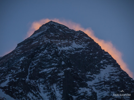
Grinning through the pain during the worst bonk of my life.
It seems terribly cliché what happened next. A few days earlier I swapped emails with my dad, explaining the stomach issues and the bout with altitude. He responded with a quick note “Get better, keep going. I have a space on my office wall for that photo of Everest.”
It was my dad who first took me to the mountains, bought me my first backpacking kit, and taught me the beauty of wilderness and the simplicity of traveling only with what we can carry. With him, I discovered my love for the mountains. I owe him a lot for those early experiences.
It’s been a long time since we’ve actually shared a trail together, however. Nagging knees, fickle kidneys, and sleep apnea have understandably kept my dad closer to the roads lately. My photos and trip reports have replaced (however incompletely) the annual backpacking trips we used to share.
I think its fair to blame him for getting me here in the first place. So it seemed fitting a little nudge from my father’s email was exactly what I needed to get me going again. I was half a world away, alone, tired, and above the clouds in Gokyo, but was nice to share the trail with him again.
I stood back up, again, trying to translate my mental energy into physical energy. Babysteps. A step here. A step there. Slowly, I made progress. And slowly, the clouds pulled farther and farther back, revealing more and more.
Eventually, I gained the summit. But the summit itself was not so important. I’d have certainly stopped earlier had I been convinced the view would have been equal. Then again, maybe that’s why they are there, and why we all want to stand on top of them. Because the views are always better.
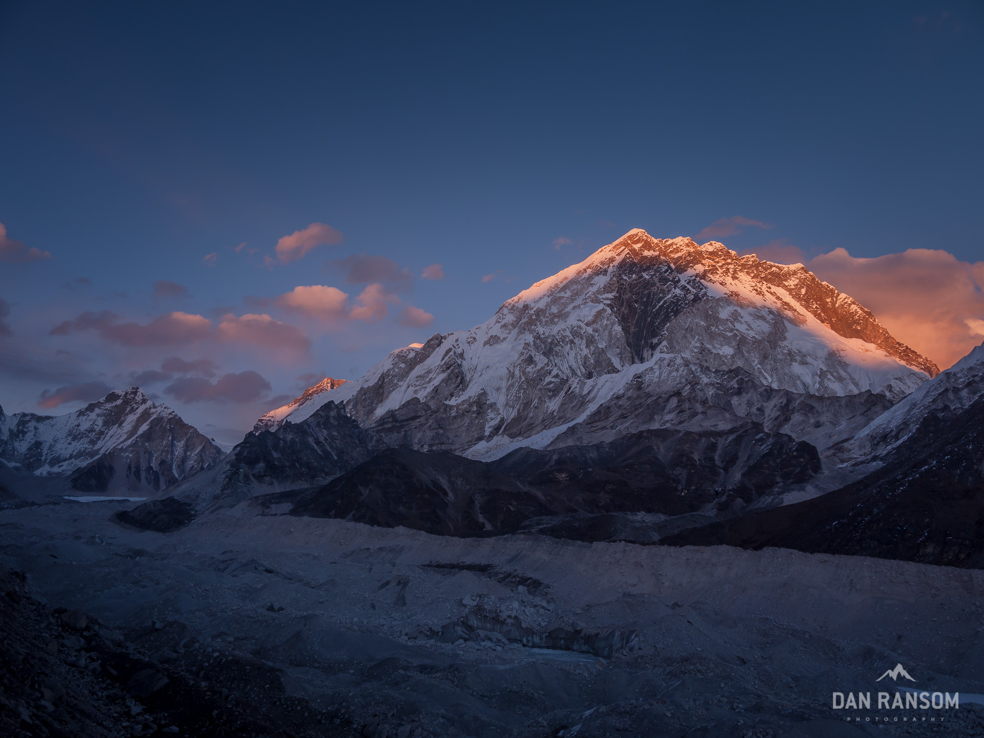
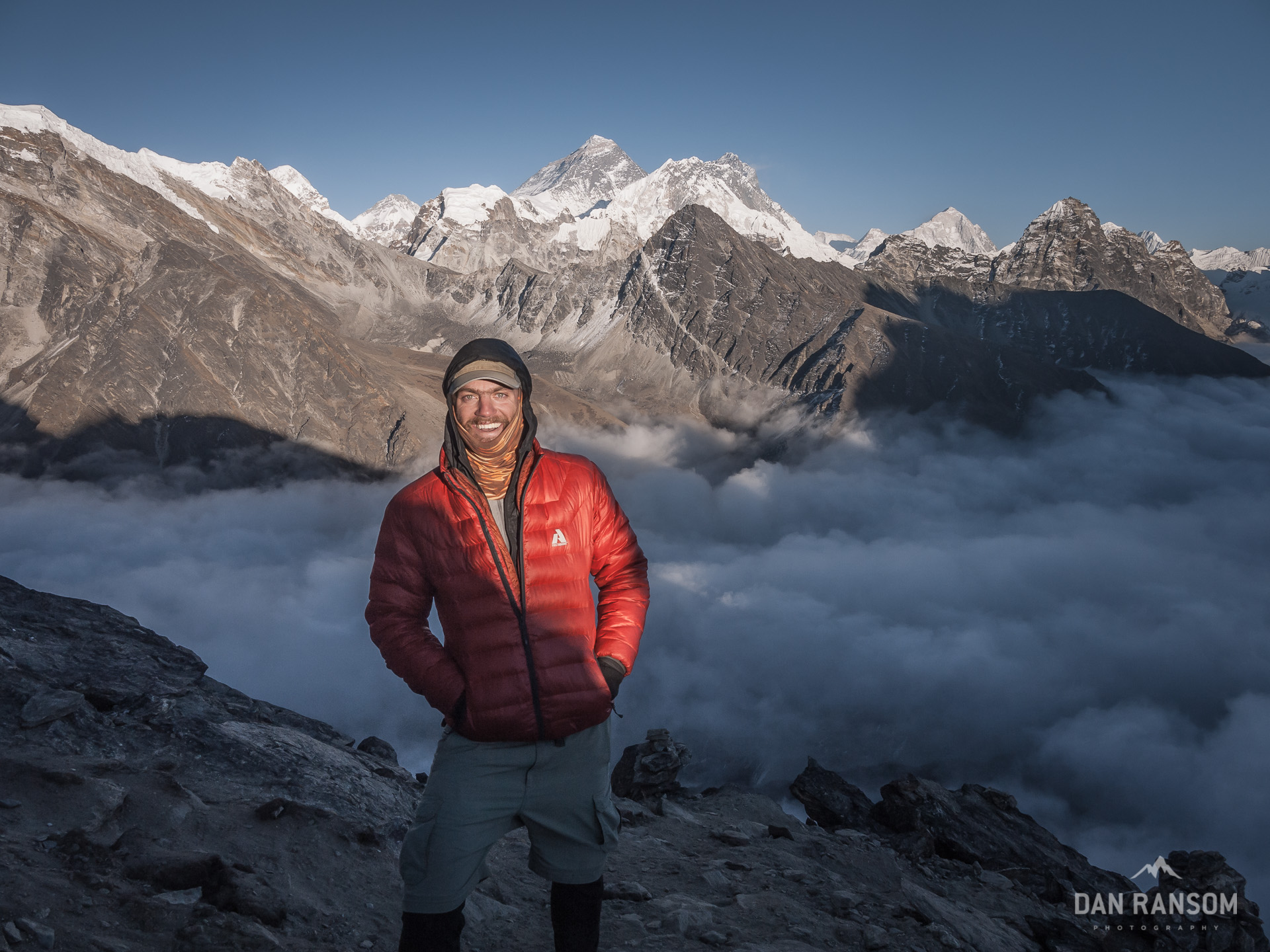
For the next hour, I watched as the clouds slowly retreated back down the valley, the last of the sunlight inch up the faces of three of the world’s biggest mountains before disappearing, only for the sky to softly blend into rich hues of pink and purple.
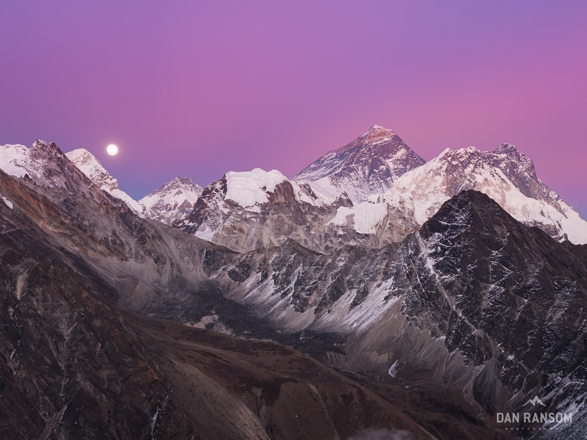
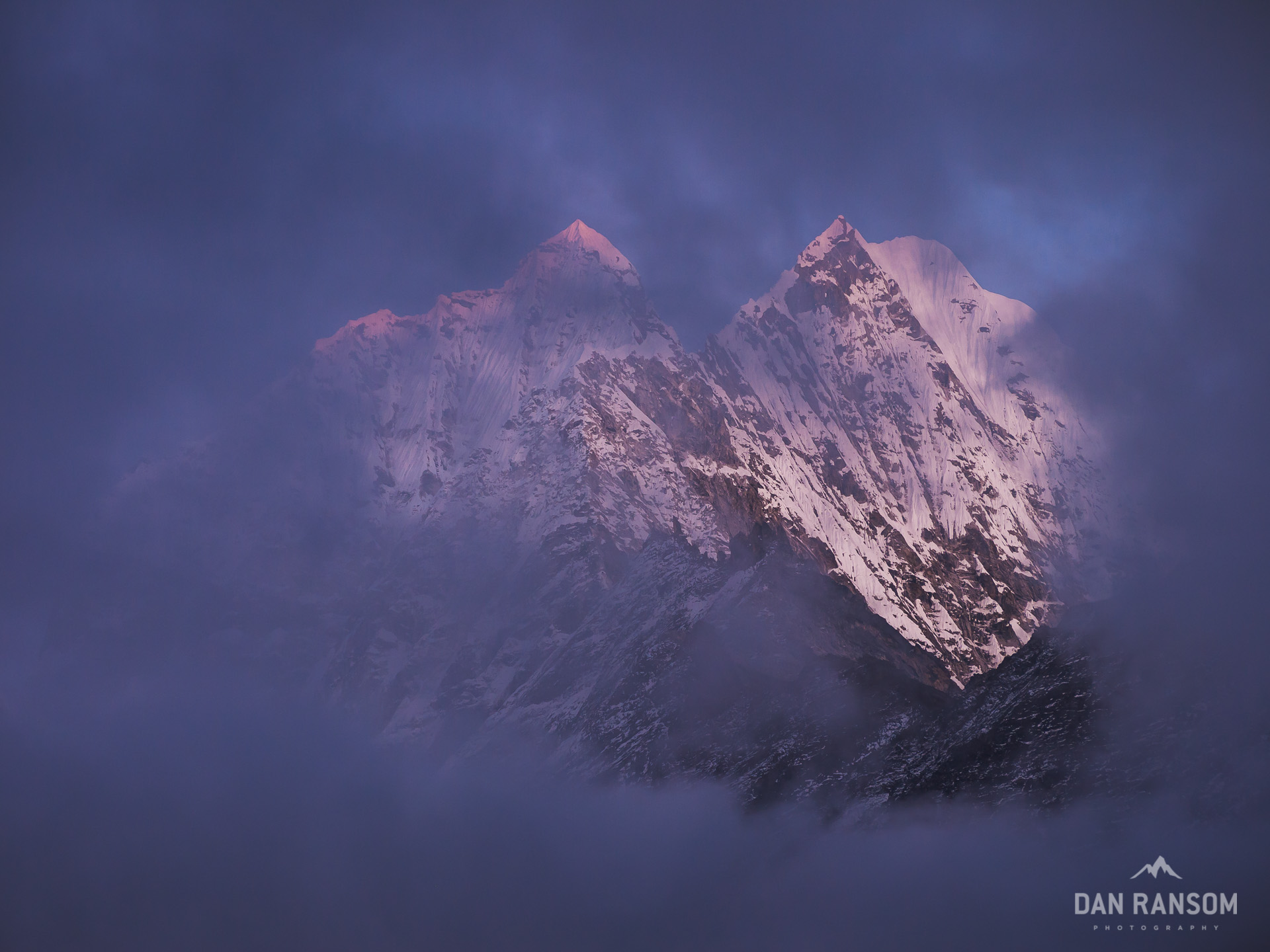
Full moon rising beside Mount Everest
The alpenglow seemed to last forever, and I stayed until I couldn’t feel my toes or fingers anymore. I wasn’t equipped to sit around at 5300 meters in 40 km/h winds while shooting photos. I was equipped to either be moving, or sleeping. And the escalating winds and lack of sun meant the temperature was well below freezing by now, and my wimpy fleece gloves and beanie weren’t up to the task. I fired off a couple more images of Everest in the fading light, did a couple jumping jacks to try and warm up, recklessly stuffed the camera and tripod in my pack, fumbled to get my headlamp on, and started heading down.
When you’re freezing cold, and have gravity in your favor, It’s amazing how fast you can move. An hour earlier, I was crushed, unable to make progress. Now, illuminated by the small beam of my headlamp, I was cruising along, and the slope that took a solid two hours to get up took about 30 minutes to descend.
Ah, sweet redemption. Finally feeling sufficiently warm, and pleased with the gamble that had more than paid off, I strode into the guesthouse dining hall. The crew, now back up to a dozen strong, were already polishing off their dinners. The perma-grin I was wearing must have given away the story before I even opened my mouth.
“We almost sent the search party up there for ya. Did you make it?”
“Yeah, but just barely.”
“And???” It was an impatient demand for a more complete explanation. They wanted the details. But I just wanted some food.
“It was amazing. Better than I even imagined…”
I almost wondered if they really believed me. The clouds had blotted out the sky for the entire afternoon in Gokyo. They likely didn’t see much, until it finally cleared at dusk. I almost felt like I needed to offer some photographic evidence to prove it. The camera was produced, and slowly circled the table, everyone taking a look.
Not that anyone needed any more reason to get up Gokyo Ri. The crew quickly decided on an itinerary for the next day. Head up the Gokyo valley in the morning, and then hope for a similar sunset on Gokyo Ri in the evening. I laughed, and then explained I probably wouldn’t join them. I wanted to sleep in. I think they understood why.
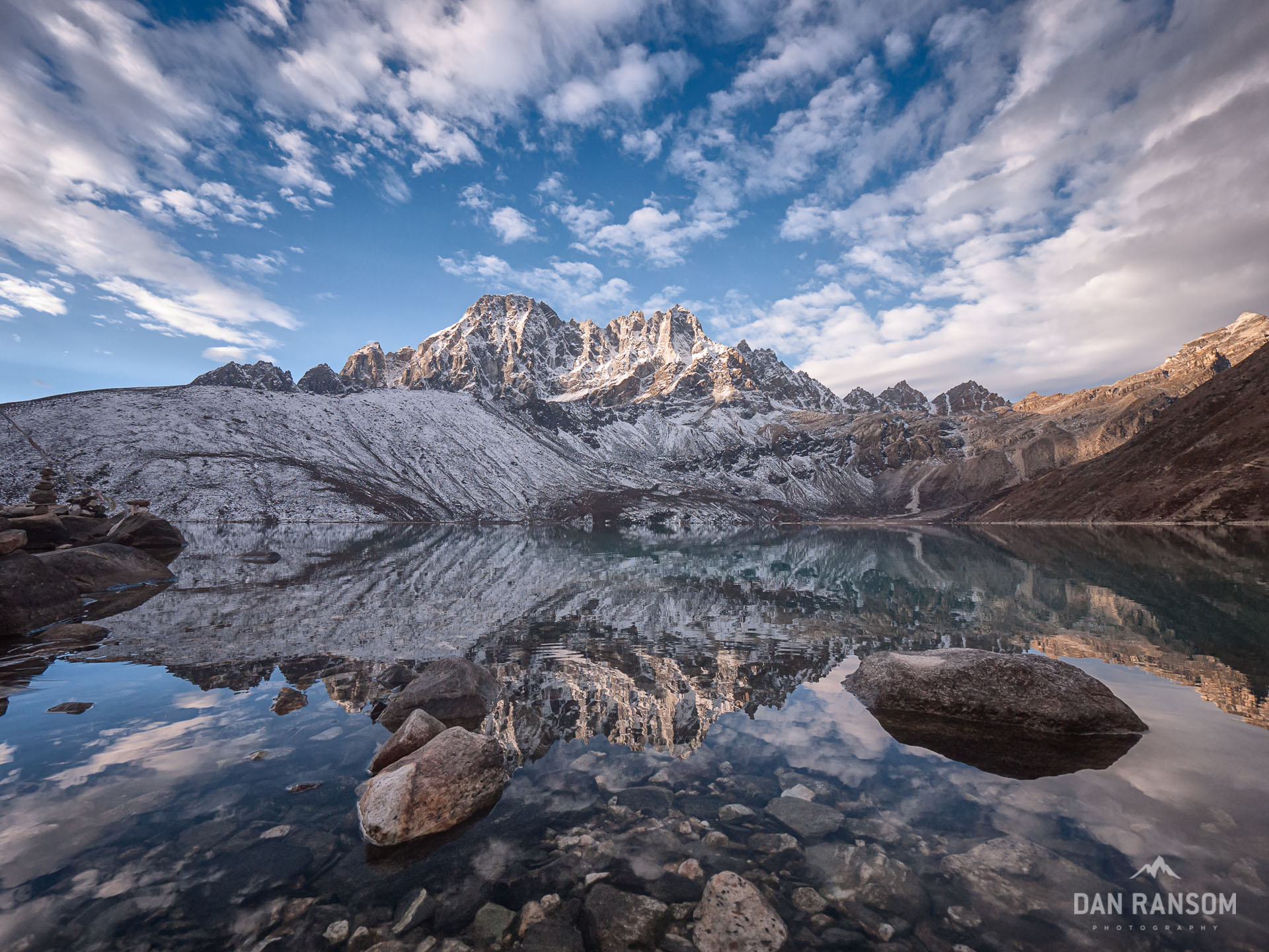
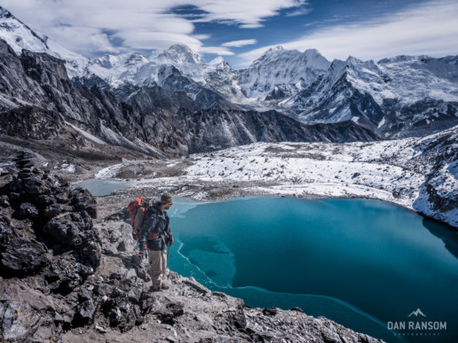
Early morning at Gokyo Lake
Great story, unbelievable photography. Well done.
Namaste, Rick
Quite the adventure! Looking forward to referencing your trip around the dinner table for years to come.
The most amazing photography of the Himalayas I’ve seen yet! Would love to trek around there.
Gorgeous Dan, are they all from your Gf1? I’m planning to head to a similar part of the world this year with the Gf1 and 7-14, your shots confirm it was the right choice.
Yep. Everything from the Khumbu is on the GF1. It’s a great compact camera.
Hey Dan,
Preparing to do Three Passes in April. Is the section of Cho La on the glacier dangerous, like do you need to be roped up?
Awesome blog, thanks for all the info and insight.
Best,
Matt
Hey Matt,
Cho La is not dangerous, can definitely be done without roping up. There was a small crevasse while we were there but with even a bit of common sense it was straightforward. That said, it’s conditionally variable, but mainly because of snow depth, not technical ice. In April my guess is you will be fine.
Enjoy!